Winter Storm Warnings Issued in Northeastern Ontario
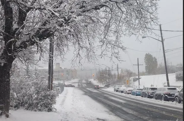
A harsh winter storm is hitting southern and eastern Ontario, prompting Environment Canada to issue winter storm warnings, snowfall warnings, and freezing rain warnings across a wide area. These alerts extend from Parry Sound north to Timmins and from Sault Ste. Marie to Mattawa.
In the affected regions, residents can expect up to 20 centimetres of snow, particularly from Sault Ste. Marie north to Cochrane. Environment Canada meteorologist Eric Tomlinson noted that the weather situation will be messy, starting with snow and potentially transitioning to ice pellets and freezing rain.
As the storm approaches, many school buses in the impacted areas have been cancelled for Wednesday. This decision reflects the anticipated hazardous travel conditions that are expected to develop.
Ontario’s 511 reports that highway conditions are currently ranging from partly snow-covered to fully snow-covered, with some areas experiencing reduced visibility. Travelers are advised to prepare for quickly changing and deteriorating travel conditions.
Coquihalla Highway Under Severe Weather Alert
In addition to the warnings in northeastern Ontario, hazardous winter conditions are expected on the Coquihalla between Hope and Merritt due to a winter storm warning. Up to 60 centimetres of snow is forecasted to fall on the Coquihalla by Thursday morning.
Strong southwest wind gusts of up to 100 km/h are also anticipated, which could result in near-zero visibility due to blowing snow. Environment Canada has warned that snow will begin in earnest late Wednesday afternoon as the low approaches the highway.
Officials are urging all residents and travelers in the affected areas to stay updated on the latest weather forecasts and to exercise caution while traveling. Details remain unconfirmed regarding the full impact of the storm, but the situation is being closely monitored.